Küldetés
Az LTER Magyarország hozzá kíván járulni az életminőség javításához, hosszútávú és komplex ökológiai és szocio-ökológiai kutatásokkal helyi, országos, regionális, kontinentális és globális skákán egyaránt.
Célok
A hálózat célja az ökoszisztémákban zajló folyamatok széles körének megértése különböző térbeli és időbeli skálán, és általános ökológiai és szocio-ökológiai ismeretek létrehozása hosszú távú, interdiszciplináris kutatás, információszintézis és elméletfejlesztés útján. Az élő környezetet elsősorban az ember alakítja, és az visszahat az emberi élet minőségére, ezért az élő környezet változásait és a mögöttes ökológiai folyamatokat a gazdasági-társadalmi környezetbe ágyazottan kutatjuk, széles körű hazai és nemzetközi együttműködésben.
A hazai LTER hálózat része az előkészítési fázisban lévő európai eLTER infrastruktúrának, illetve alapító tagja 1995 óta a Nemzetközi Hosszútávú Ökológiai Kutatóhálózatnak (ILTER: International Long-Term Ecological Research Network).
Tevékenység
A LTER Magyarország hálózat a Kiskunságban és a Balaton vízgyűjtőjében több mintaterületen hosszútávú és komplex ökológiai és szocio-ökológiai vizsgálatokat végez monitorozás és terepkísérletek segítségével.
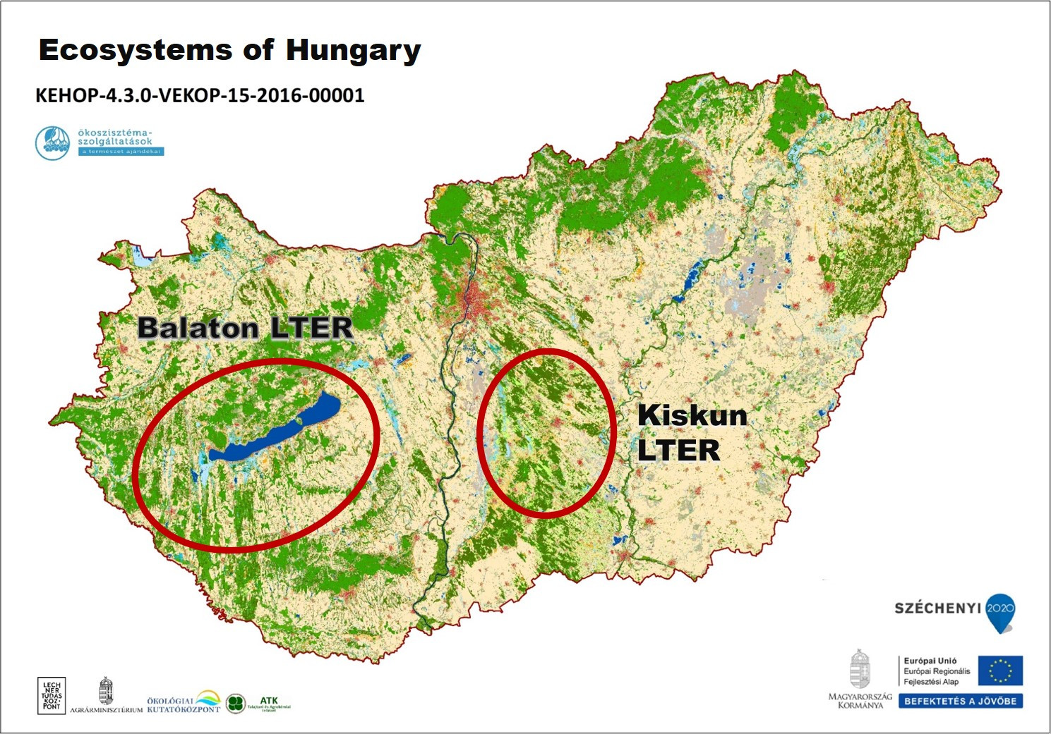
Helyszínek
A Kiskunságban a terepi kutatás központja az Ökológiai Kutatóközpont fülöpházi Fejes-tanya kutatóállomása, a Balaton esetében pedig a Balatoni Limnológiai Kutatóintézet (lásd megfelelő menüpontok). Az infrastruktúra részben a mintaterületeken van, állandó mintavételi helyek, kihelyezett műszerek és adatgyűjtők, illetve kísérleti berendezések formájában. A minták feldolgozása részben kutatóállomáson, részben a befogadó és partnerintézmény telephelyein folyik. Az LTER hálózat fontos eleme a befogadó és partner intézmény gondozásában lévő tudásbázis, ami a mintaterületeken folyó sok évtizedes kutatómunka eredménye.
Fő kutatási témák
- Klímaváltozás és földhasználat-változás
- Biodiverzitás - változás
- Anyagforgalom
- Ökológiai restauráció
- Ökoszisztéma-szolgáltatások
- Tudomány-társadalom közti interfész kiépítése